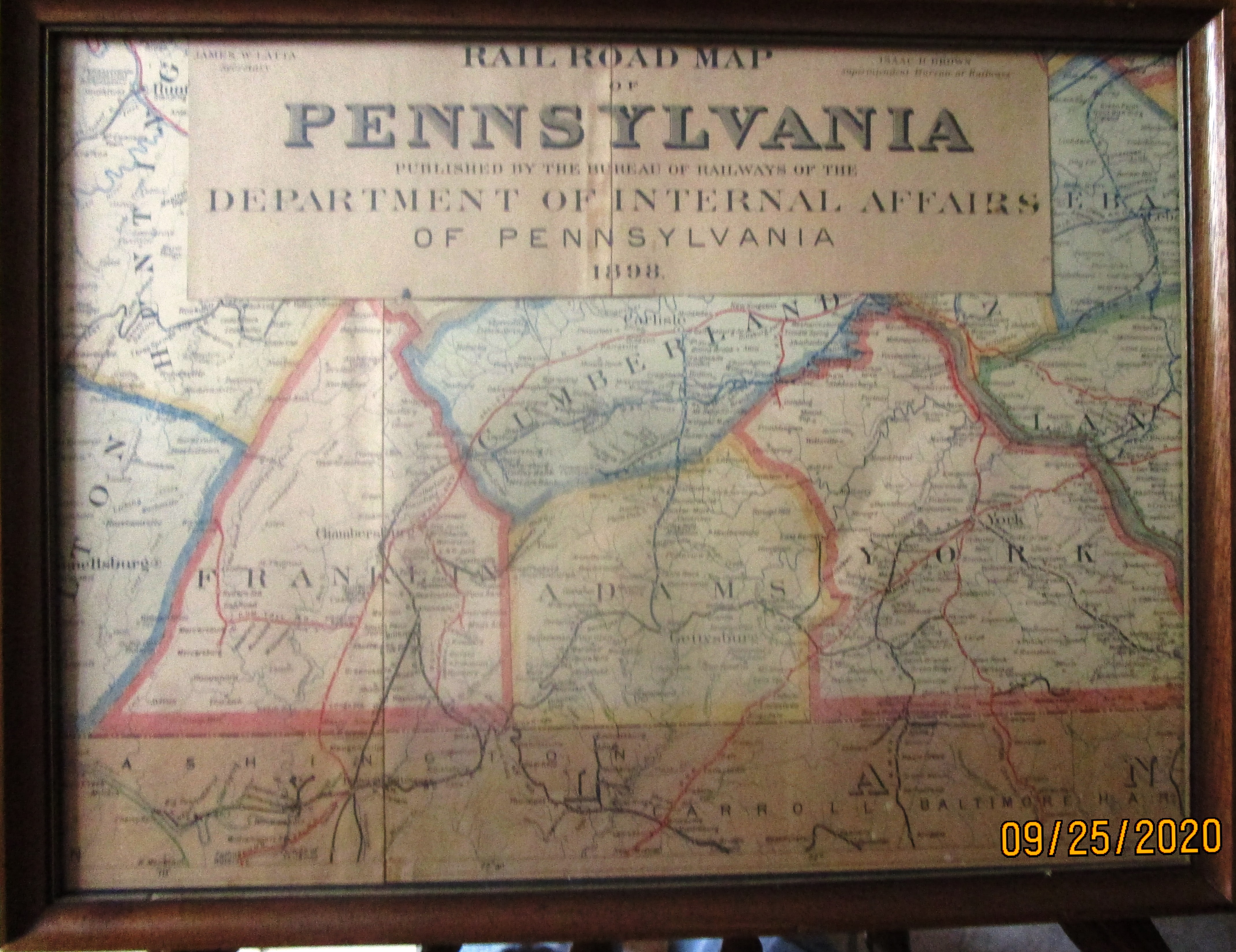
This is a framed portion of an 1898 "Rail Road Map of Pennsylvania". The map was published by; The Bureau of Railways, Department of Internal Affairs of Pennsylvania. The original was brittle and dilapidated, with portions missing. The map was rolled up upon receipt. Fortunately the center section of the roll, which included Adams and surrounding Counties, was best preserved.
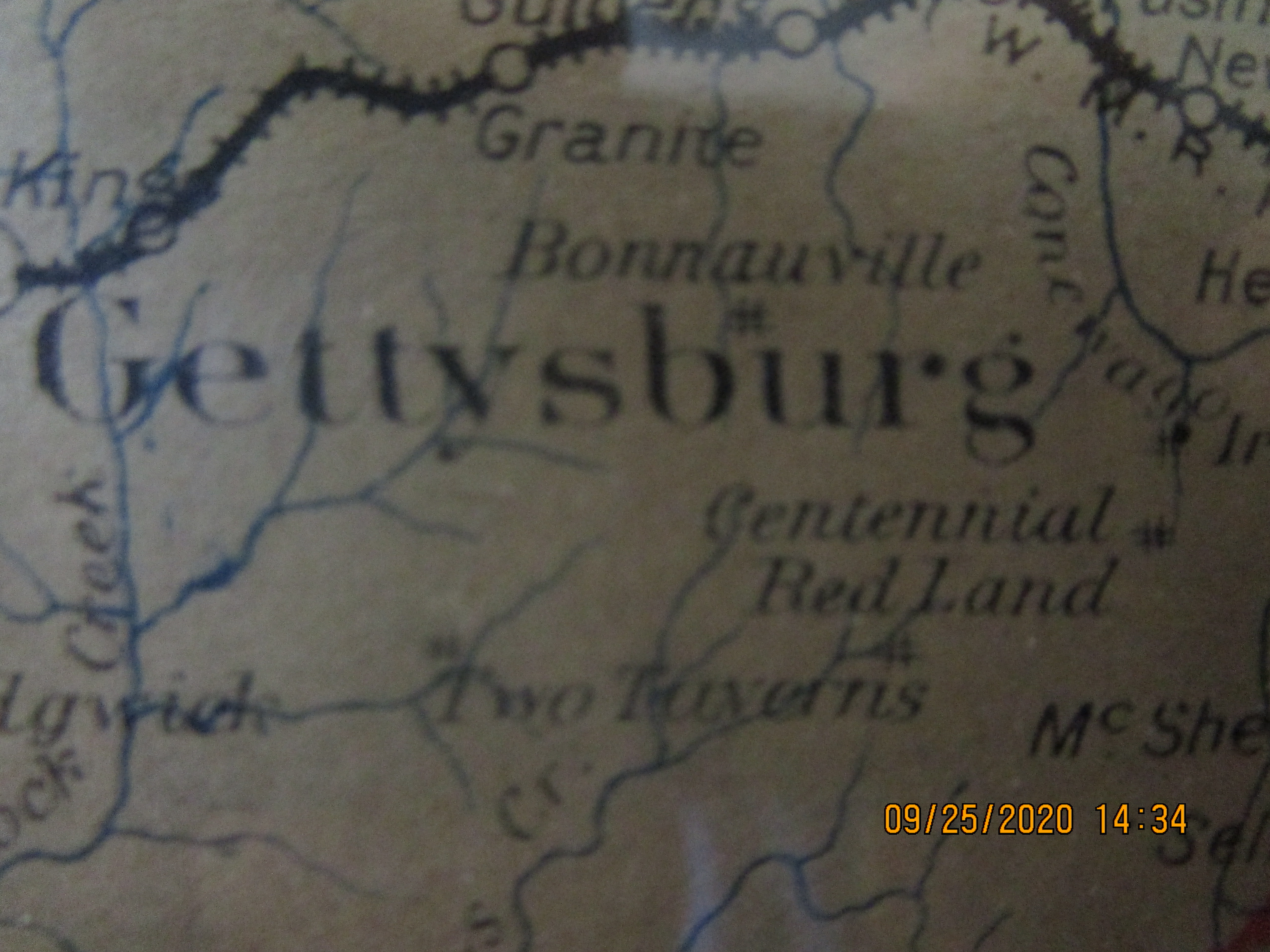
Since the inception of this catalog file, nearly twenty different spellings of the town's have been discovered. (See Cat. No. 2999-01a) Spanning the cultures of the Low Dutch until the year 1800, then the Pennsylvania Germans (speaking German) for the next century, the town's name was written as early citizenry understood it. Misspelled "Bonnauville", the name for the town of Bonneauville on this map was likely, simply a cartographers error.
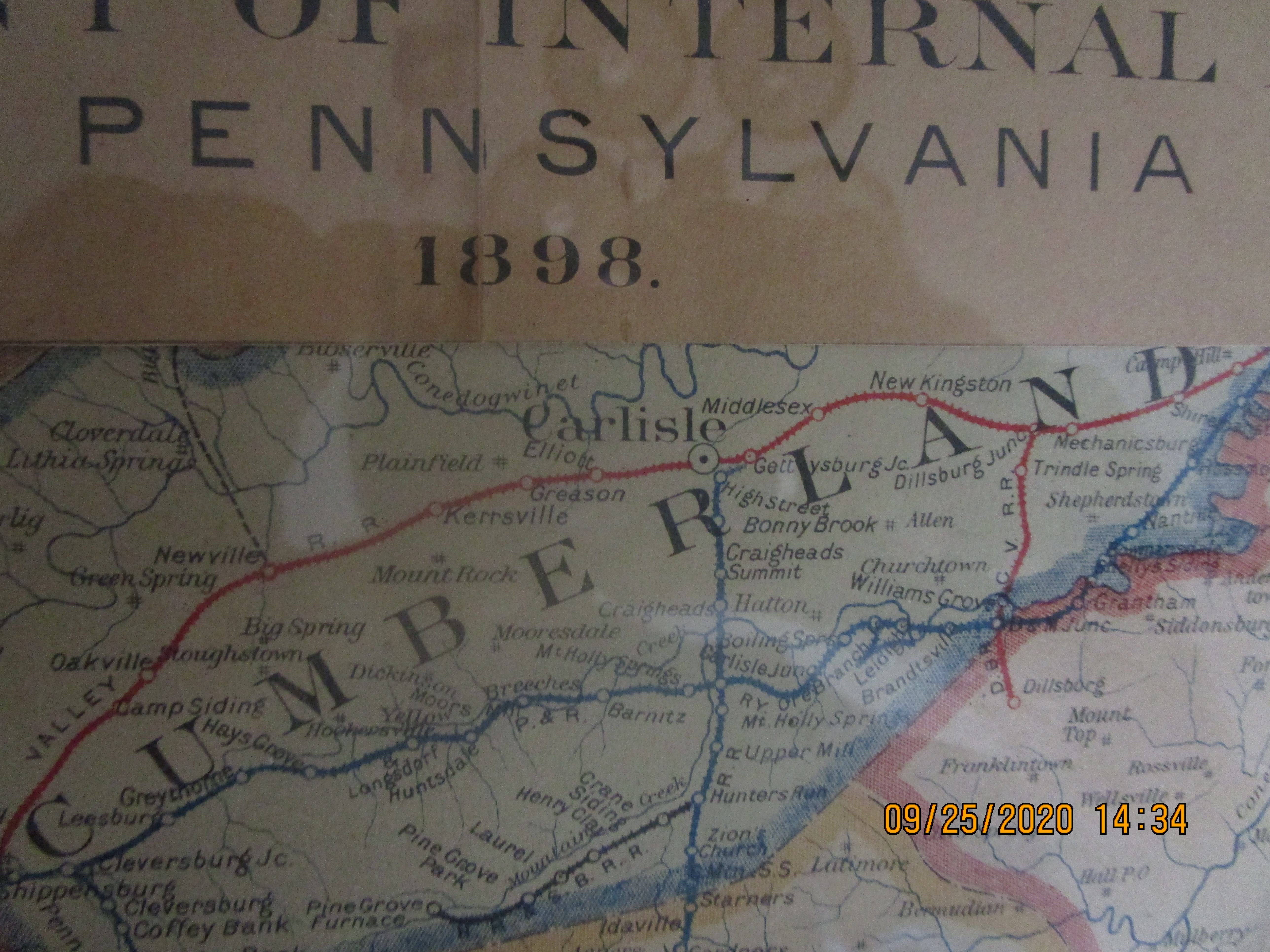
This map displays the various railroads running through Adams and surrounding counties. The closest tracks to Bonneauville, and the closest stop, was Guldens Station, about three miles north of the town.
Waterways and town names are also shown but no roadways are depicted.