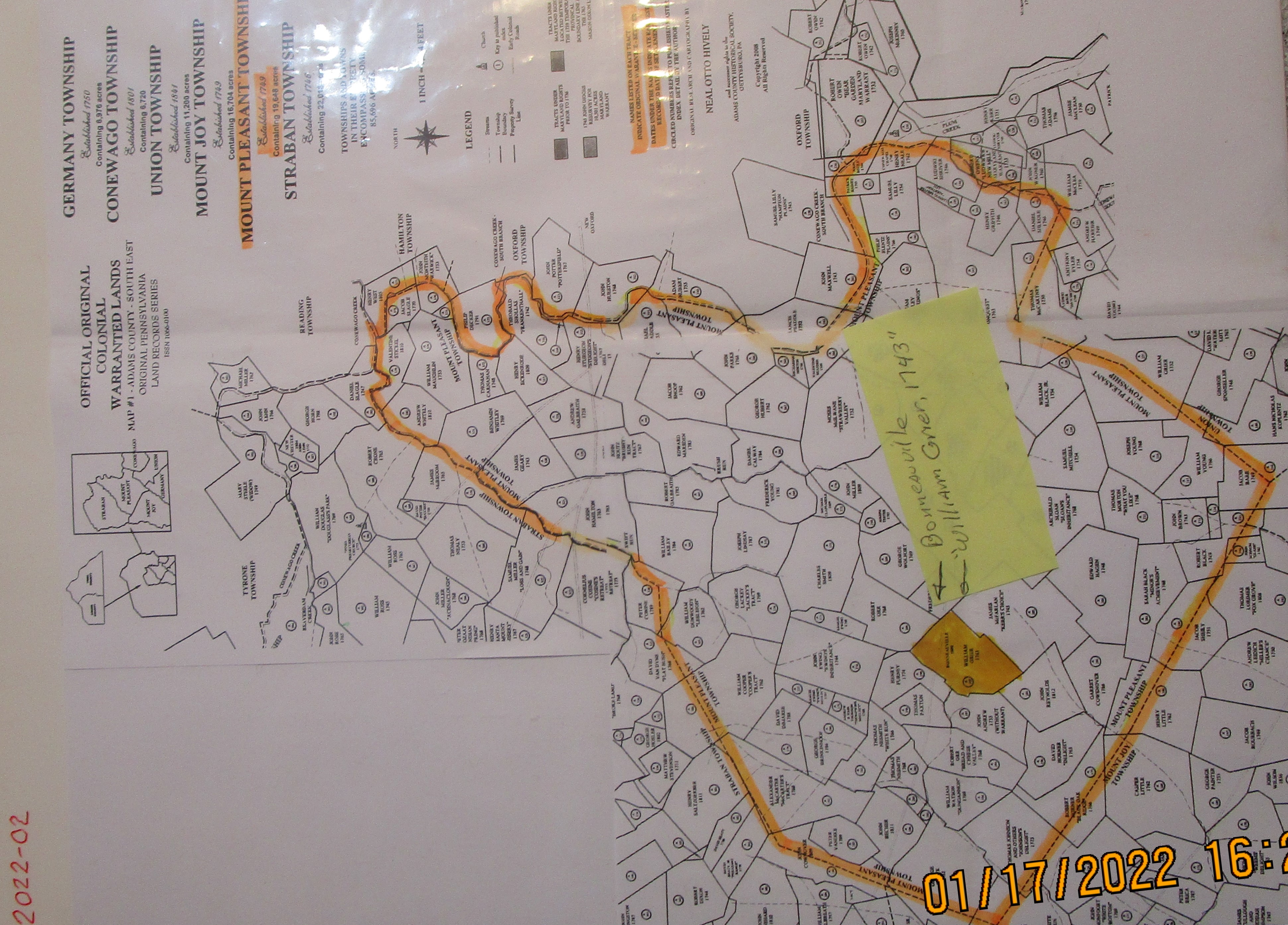
Extracted from Neal Otto Hively's map of Germany, Conewago, Union, Mt. Joy, Mt. Pleasant and Straban Townships, this map shows all of Mount Pleasant Township around the very middle of the 1700's. (The township was established in 1749) The names shown on each tract indicate original settlers.
Highlighted in orange is the William Grier plantation. Within the boundaries of the Grier tract is the name and location of the town of Bonneauville, and a date of 1800. The author likely placed the information here to orient the viewer as to where the town is located. Bonneauville was not the correct spelling of the towns name at that time. A date of 1789 found in the Pennsylavania State Archives indicates that the town predates the year 1800 by at least thirteen years.
Ref. Cat. No. 2999-01A for a study of the spelling variations of the town of Bonneauville, PA.
Rights to this map are held by the Adams County Historic Society, Gettysburg, PA.